Peter Strobl (JRC, European Union): 9h30
"What is land cover? Thoughts about the abstraction of landscape in a Digital Earth.
The talk will present some general considerations about good practices and criteria for developing classification schemes, followed by a critical review of frequently used schemes such as LCCS and EAGLE. It will focus on the needs we perceive are arising from data which are increasingly dense and complex ('Big Data') and applications which require ever more interoperability and multi-disciplinarity ('Digital Earth').
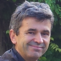 Peter Strobl works as point of reference in the Forest Resources and Climate Unit for Earth Observation (EO) data management, representing JRC in initiatives and projects on Big and Open Data and related horizontal and cross-cutting initiatives. He regularly provides technical support and strategic advice on aspects such as the Copernicus Data WareHouse (DWH), the Land and the Emergency Management Services. For this he maintains close relations with various stakeholders within and outside of the European Commission, in the public as well as in the private sector. Current work and research activities include: Copernicus High Resolution Layers (HRL), EU-DEM and other European Reference Layers, Sentinel2 and Landsat8 synergies, Big Data Applications such as the Google Earth Engine (GEE), Evolution of the European Forest Fire Information System (EFFIS), use of EO for Tree Health Monitoring, Landcover map validation, spatial pattern analysis and change detection.
Nandika Tsendbazar (WUR, The Nederlands): 10h30
Statistical validation of large scale land cover maps. Focus on Copernicus Global Land Service-Land Cover products.
 Nandika Tsendbazar is a researcher and lecturer at the Laboratory of Geo-information Science and Remote Sensing in Wageningen University and is currently working on research topics related to large scale land cover mapping and validation, including validation data collection and maintenance. This has been one of the central tasks for the Copernicus Global Land Service Dynamic Land Cover project funded through the JRC-EC. In this project she led a team to collect high quality land cover validation dataset at global scale with contributions of 30 regional experts. Other related activities include the comparison and integration of global land cover maps, the Proba-V Mission Exploitation Platform Land Cover Monitoring, and WorldCover project. Her research also focuses on statistical analysis on map accuracies and map validation from different user’s perspectives.
Christophe Sannier (SIRS, France): 11h30
Operational Land cover / use mapping from local to continental scale
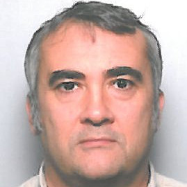 Christophe SANNIER is currently Scientific Director at SIRS since 2016 and has worked at SIRS since 2007. Prior to that he was a lecturer at Cranfield University for 10 years after completing his PhD in the same university on the applications of Satellite imagery for strategic monitoring of crop yields and conditions of rangeland vegetation in Southern Africa. He was also visiting fellow of Cranfield University and has been involved in a large number of research and consultancy projects in relation to the EU Copernicus programme and with the European Space Agency (ESA).
Christian Hoffmann (Geoville, Austria): 14h00
Lessons learned from the last 21 years of commercial land monitoring services
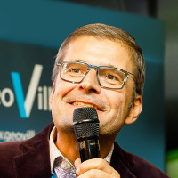 Christian Hoffmann is an Earth observation enthusiast holding a doctorate degree in Cartography from the University of Vienna. He has over 25 years of experience in Earth observation and GIS applications working for the United Nations, the European Commission and Intergraph. In 1998, he founded GeoVille Information Systems and Data Processing GmbH with the vision to remap the unknowns of human activities around the world to provide better data for decision making and risk management. In its 19 years of operation, he formed GeoVille to the number one SME in Europe for Land Monitoring with a very active role in the European Commission’s Copernicus programme. At GeoVille, Christian is responsible for strategy consulting and the ongoing growth and business of GeoVille. As the Managing Director of GeoVille he leads the company strategy and sets the frame for GeoVille to be a forerunner in next generation Earth observation solutions.
Ruben Van de Kerchove (VITO, Belgium): 15h00
Global land cover mapping at 10/100m tailored to the user needs
In May of this year, the Copernicus Global Land Service released its first global land cover product. This product contains besides a discrete classification with 23 classes also fraction cover layers for ten base land cover classes at 100m resolution. In September of this year, also the ESA WorldCover project was kicked off aiming at a 10m global land cover map based on Sentinel-1 and 2 data. Both projects (will) provide a new baseline global land cover product that is developed and validated in almost near-real time and at the same time maximizes the impact and uptake for the end users. This presentation will zoom in on both products outlining their strengths and weaknesses with a special focus on the role of the users.
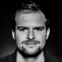 Ruben Van De Kerchove is an environmental scientist specialized in the spatio-temporal analysis of ecosystems. After completing his Master and PhD in Geography at Ghent University (Belgium) in 2007 and 2012, respectively, Ruben worked as a postdoctoral researcher at the Université Libre de Bruxelles. Since 2014, Ruben is part of VITO Remote Sensing, responsible for projects dealing with applications in biodiversity and land use land cover mapping. Currently he is among others responsible for the Sentinel-2 processing workflows in the framework of the Belgian Collaborative Ground Segment Terrascope and the Copernicus Global Land Service (Land Cover). Furthermore, Ruben is the project manager of the recently started ESA WorldCover project aiming at a global land cover map based on Sentinel-1 and 2 data at 10m resolution.
Pierre Defourny (UC Louvain, Belgium): 16h00
Lessons learnt from global land cover mapping: achievements, issues and forthcoming challenges
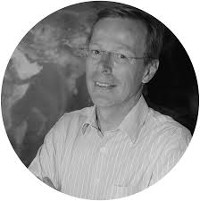 Pierre Defourny, full professor at UCLouvain, leads the Environmetrics and geomatics lab of the Earth and Life Institute at the Université catholique de Louvain (Belgium). Trained as bioengineer with remote sensing experiences in various continents, he coordinates several flagships projects supported by the European Space Agency including the Land Cover ECV team for the Climate Change Initiative, the Sen2Agri and the Sen4CAP projects. From GLC2000 and GlobCover to the Copernicus Climate Service – Land Cover, his research team is in charge of global land cover mapping using multi-mission approach as well as of land cover characterization down to metric resolution.


 Peter Strobl
 Christophe SANNIER is currently Scientific Director at SIRS since 2016 and has worked at SIRS since 2007. Prior to that he was a lecturer at Cranfield University for 10 years after completing his PhD in the same university on the applications of Satellite imagery for strategic monitoring of crop yields and conditions of rangeland vegetation in Southern Africa. He was also visiting fellow of Cranfield University and has been involved in a large number of research and consultancy projects in relation to the EU Copernicus programme and with the European Space Agency (ESA).
 Christian Hoffmann is an Earth observation enthusiast holding a doctorate degree in Cartography from the University of Vienna. He has over 25 years of experience in Earth observation and GIS applications working for the United Nations, the European Commission and Intergraph. In 1998, he founded GeoVille Information Systems and Data Processing GmbH with the vision to remap the unknowns of human activities around the world to provide better data for decision making and risk management. In its 19 years of operation, he formed GeoVille to the number one SME in Europe for Land Monitoring with a very active role in the European Commission’s Copernicus programme. At GeoVille, Christian is responsible for strategy consulting and the ongoing growth and business of GeoVille. As the Managing Director of GeoVille he leads the company strategy and sets the frame for GeoVille to be a forerunner in next generation Earth observation solutions.
 Ruben Van De Kerchove is an environmental scientist specialized in the spatio-temporal analysis of ecosystems. After completing his Master and PhD in Geography at Ghent University (Belgium) in 2007 and 2012, respectively, Ruben worked as a postdoctoral researcher at the Université Libre de Bruxelles. Since 2014, Ruben is part of VITO Remote Sensing, responsible for projects dealing with applications in biodiversity and land use land cover mapping. Currently he is among others responsible for the Sent
